


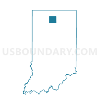
TIPPECANOE, Marshall County, Indiana
About
Outline

Summary
| Unique Area Identifier | 579692 |
| Name | TIPPECANOE |
| County | Marshall County |
| State | Indiana |
| Area (square miles) | 35.80 |
| Land Area (square miles) | 35.75 |
| Water Area (square miles) | 0.05 |
| % of Land Area | 99.86 |
| % of Water Area | 0.14 |
| Latitude of the Internal Point | 41.21960320 |
| Longtitude of the Internal Point | -86.10306820 |
Maps


Graphs
Select a template below for downloading or customizing gragh for TIPPECANOE, Marshall County, Indiana


Neighbors
Neighoring Voting District (by Name) Neighboring Voting District on the Map
- BOURBON 1, Marshall County, IN
- BOURBON 2, Marshall County, IN
- ETNA, Kosciusko County, IN
- FRANKLIN 1, Kosciusko County, IN
- HARRISON 2, Kosciusko County, IN
- NEW CASTLE, Fulton County, IN
- WALNUT 2, Marshall County, IN
Top 10 Neighboring County Subdivision (by Population) Neighboring County Subdivision on the Map
- Harrison township, Kosciusko County, IN (3,587)
- Bourbon township, Marshall County, IN (3,152)
- Walnut township, Marshall County, IN (2,747)
- Etna township, Kosciusko County, IN (1,503)
- Newcastle township, Fulton County, IN (1,398)
- Tippecanoe township, Marshall County, IN (1,313)
- Franklin township, Kosciusko County, IN (1,127)
Top 10 Neighboring Unified School District (by Population) Neighboring Unified School District on the Map
- Tippecanoe Valley School Corporation, IN (11,727)
- Triton School Corporation, IN (5,968)
- Argos Community Schools, IN (3,850)
Top 10 Neighboring State Legislative District Lower Chamber (by Population) Neighboring State Legislative District Lower Chamber on the Map
- State House District 16, IN (63,265)
- State House District 17, IN (61,387)
- State House District 23, IN (60,512)
Top 10 Neighboring State Legislative District Upper Chamber (by Population) Neighboring State Legislative District Upper Chamber on the Map
- State Senate District 9, IN (135,161)
- State Senate District 5, IN (127,561)
- State Senate District 18, IN (118,690)
Top 10 Neighboring 111th Congressional District (by Population) Neighboring 111th Congressional District on the Map
Top 10 Neighboring Census Tract (by Population) Neighboring Census Tract on the Map
- Census Tract 9612, Kosciusko County, IN (5,766)
- Census Tract 208, Marshall County, IN (5,163)
- Census Tract 9624, Kosciusko County, IN (3,759)
- Census Tract 9530, Fulton County, IN (3,220)
- Census Tract 207.02, Marshall County, IN (3,152)
- Census Tract 9625, Kosciusko County, IN (2,969)
Top 10 Neighboring 5-Digit ZIP Code Tabulation Area (by Population) Neighboring 5-Digit ZIP Code Tabulation Area on the Map
- 46975, IN (14,691)
- 46501, IN (3,856)
- 46504, IN (3,413)
- 46524, IN (2,326)
- 46539, IN (2,298)
- 46570, IN (1,060)